A route tells you how far and how much climbing. It does not tell you how long you will be out, how hard to ride the third climb so the fifth is still there, or how much to carry. Pacer works that out before you leave.
It takes a saved route, your FTP, your weight and your bike, and rides the route in a physics model: the power you put out against gravity, rolling resistance and air, every 30 m of the way, on heights read from the ground along the whole line. What comes back is a riding time, a power target for every climb, the energy, the food and water, and, for a ride with a card, when you reach each control.
The route here is a 104 km loop from Freiburg over the Schauinsland and the Feldberg, ridden by a rider with an FTP of 250 W who weighs 75 kg.
1. Start with a route
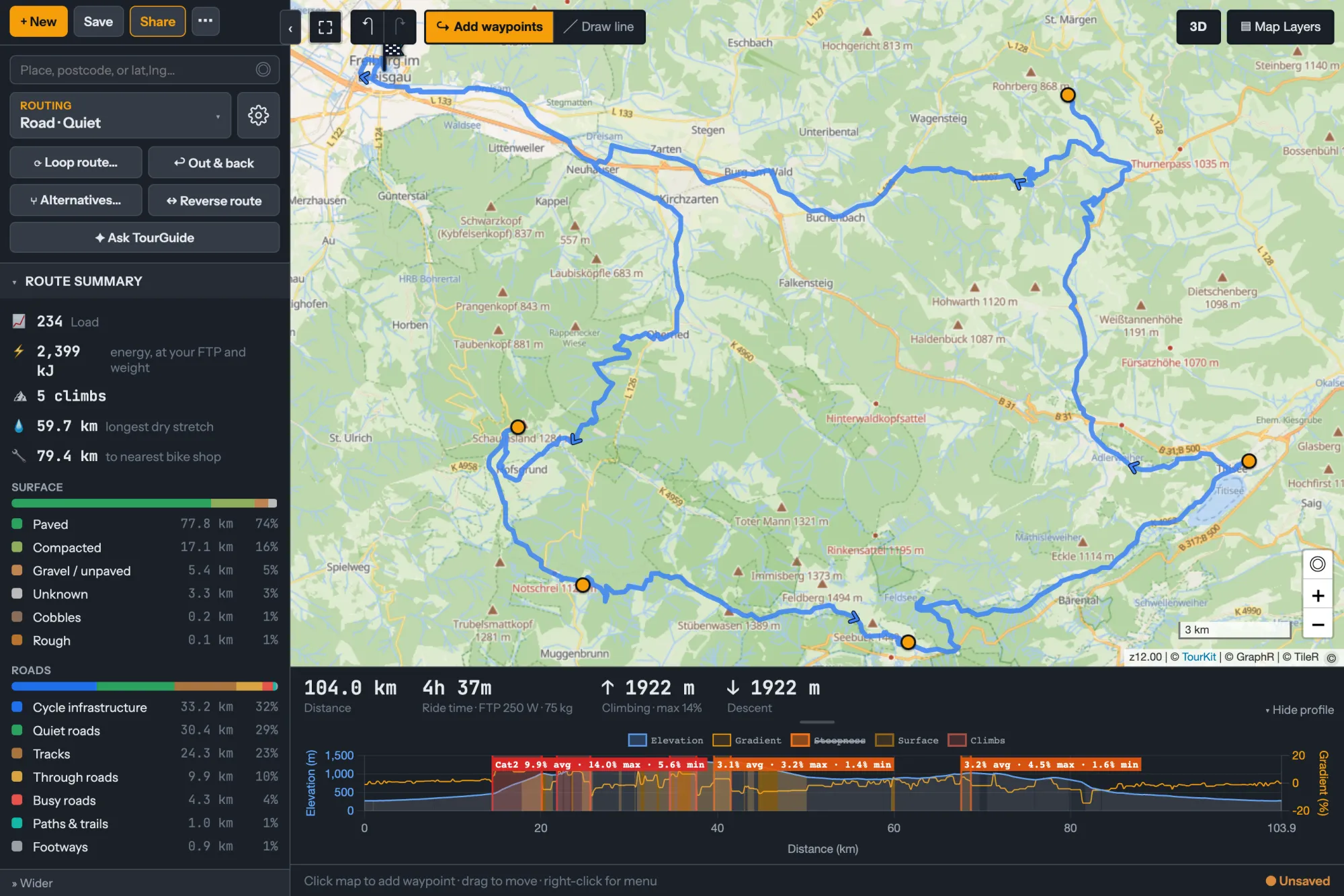
Plan it in the Planner, or import a GPX, and save it. An imported route takes its heights from the ground too, not from the file, so a climb drawn by a barometer on someone else's ride does not end up in your plan.
New to the Planner? Your first route in the Planner takes under two minutes.
2. Open it in Pacer
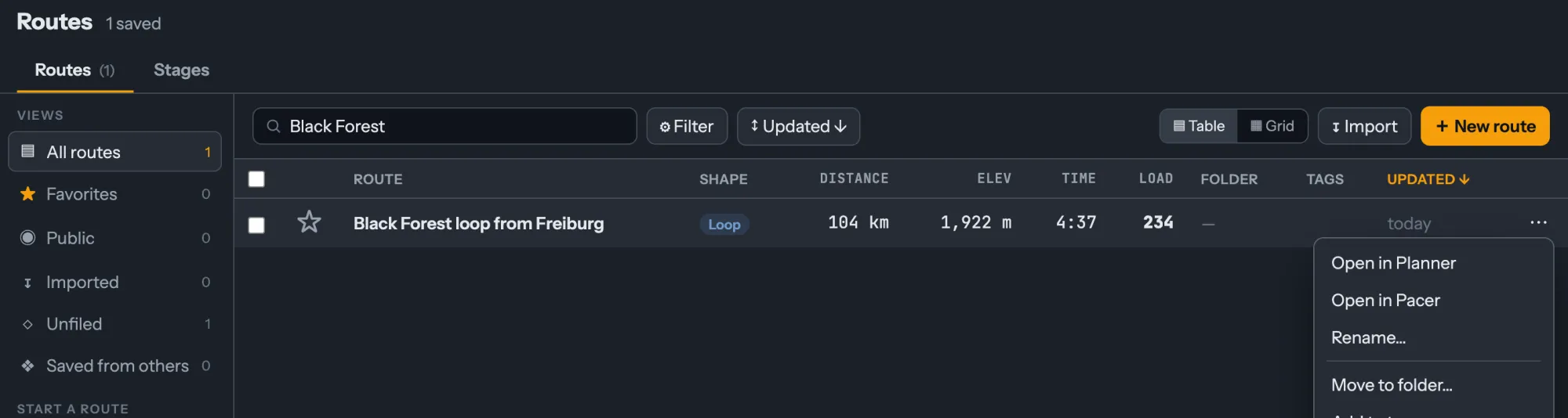
In Routes, open the route's menu and choose Open in Pacer. You can also open Pacer and choose a route there.
3. Read the plan
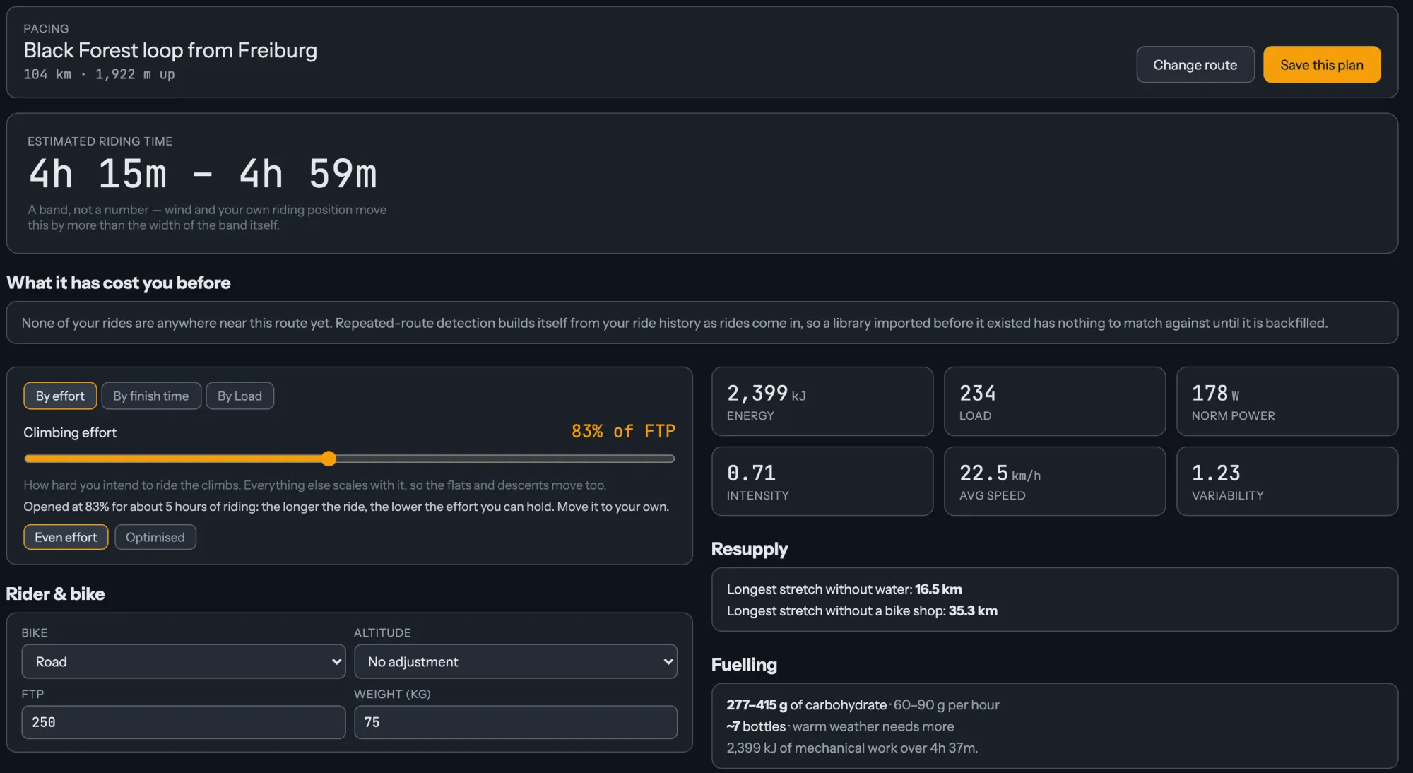
At the top is the riding time, as a band: 4 h 15 m to 4 h 59 m. It is a band because wind and your own riding position can move your time by more than its width, and a single number would claim more than the model knows.
Pacer opens at an effort for a ride this long. Effort here is how hard you ride the climbs, as a share of your FTP, and everything else scales with it. For about five hours that is 83%, which is 208 W on every climb. The longer the ride, the lower Pacer starts, because the lower the effort you can hold. Move the slider to your own.
Beside it is what the ride costs:
- Energy: 2,399 kJ of work.
- Load, Norm Power and Intensity: 234, 178 W and 0.71, the same measures your rides are scored in, so you can set the plan against your training.
- Speed and variability: 22.5 km/h on average, and a variability of 1.23, because a ride with two long climbs is not ridden at one power.
- Resupply: the longest stretch without water is 16.5 km, and without a bike shop 35.3 km.
- Fuelling: 277 to 415 g of carbohydrate at 60 to 90 g an hour, and about seven bottles, more on a warm day.
Under Rider & bike, change the bike, your FTP or your weight, and the plan follows. Altitude adjusts your power for a ride high enough to cost you some, acclimatised or not.
4. Choose how you set the effort

Three tabs ask the same question three ways:
- By effort: you set how hard, and Pacer says how long.
- By finish time: you set how long, and Pacer works back to the effort. 4 h 30 m on this loop needs 87% of FTP, a Load of 246.
- By Load: you set a training target, for a ride that is a session rather than a race against the clock.
Every figure in this post is at Even effort, the switch under the tabs: every climb at your effort, easing off between them.
5. Ride every climb to its number
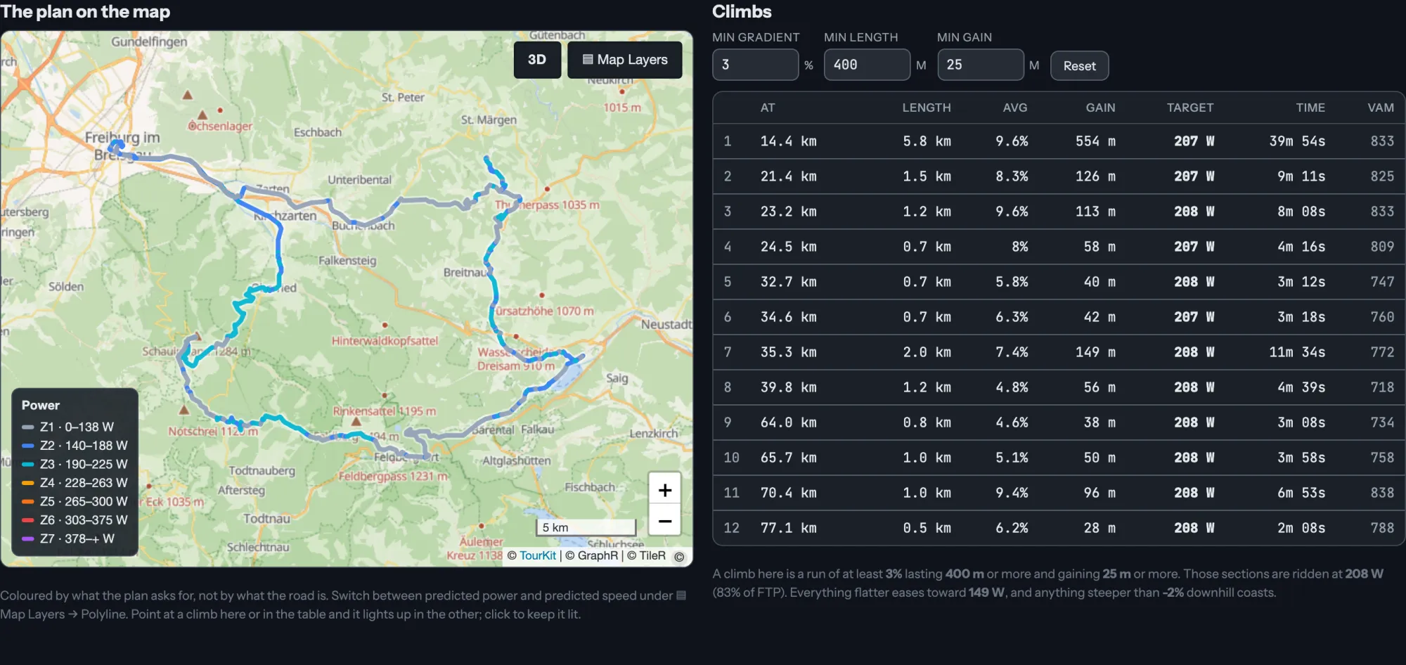
The map colours the route by the power the plan asks for. Beside it, the climbs table gives each climb where it starts, its length, gradient and gain, the power to ride it at, the time it takes and the VAM. This loop has twelve. The first, 14.4 km in, is 5.8 km at 9.6% and gains 554 m: 39 min 54 s at 208 W. Between the climbs the plan eases toward 149 W, and on a descent steeper than 2% you coast.
A climb here is at least 3% for 400 m and gains at least 25 m. Change those and the table follows.
That number on each climb is the point of the plan. Ride the long one at 208 W and you have the legs the rest of the day assumes you have.
6. See where the time goes
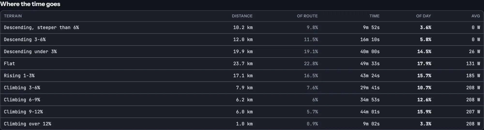
Where the time goes sorts the route by gradient, from steep descents to climbs over 12%, and sets the share of the distance beside the share of the day. On this loop, 5.9 km at 9 to 12% is under 6% of the distance and takes 44 minutes, 16% of the riding time. That is where a gear you do not have costs you.
What it asks of you then sets the hardest minute, five, ten and twenty minutes and the hardest hour of the plan beside your best power over the last 42 days, with your all-time best next to it, so you can see whether the plan is one you have ridden lately or one you are planning to grow into.
7. Pace it by the clock
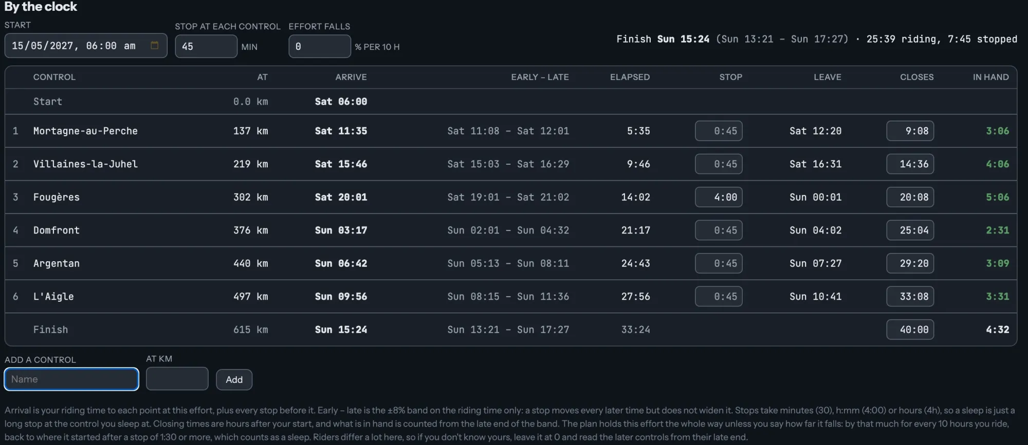
When a ride has a start time and points you have to reach, By the clock turns the plan into a timetable. Mark your controls on the route, set a start, give each stop its length, and type each control's closing time from your card. Pacer gives you when you arrive, how long you stop, when you leave, and how much time you have in hand, counted from the slow end of the band, so it is what you keep on a bad day.
On a long ride, Effort falls lowers your effort for every 10 hours of riding, so the later controls come later. On ten riders' Paris-Brest-Paris it fell about 6% for every 10 hours they rode.
This one is a 615 km brevet with a sleep at Fougères, from Plan a 600 km brevet and pace it to its controls. The same clock works for a sportive's cut-offs, a ferry or the last train home.
8. Save it and take it with you

Save this plan keeps it with the rider, bike, effort and altitude it was made for, so a plan made at last spring's FTP still says so. Pace Plans lists them, and opening one puts you back where you left it.
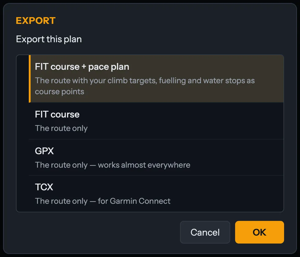
Export takes it to your bike computer. FIT course plus pace plan puts your climb targets, fuelling and water stops on the course as course points. A plain FIT course, GPX or TCX carries the route on its own.
When the ride is weeks away, Build a training plan turns its date and efforts into a training plan for it.
What Pacer does not know yet
Pacer does not model wind. On a windy day your time moves, and the band says so rather than hiding it.
Your own aerodynamics start from the defaults for your bike, a CdA of 0.32 and a Crr of 0.005 on a road bike, until you choose Fit from my rides under Your aerodynamics. That measures them from steady solo stretches of your own rides. A wheel you were sitting on reads as less drag, so it uses the stretches where you were alone.
If you have ridden the route before, What it has cost you before puts your real times on it beside the plan's: elapsed time, stops included, with the weather you had in them. It is a check you can make, not a target to chase.
Try it free at tourk.it
Captured in TourKit on a demo account with an FTP of 250 W and a weight of 75 kg. Pacer's times are a model of your riding, not a promise. Map data © OpenStreetMap contributors. Heights in Baden-Württemberg: LGL, www.lgl-bw.de, dl-de/by-2-0, modified. Heights in France: IGN, RGE ALTI, Licence Ouverte 2.0, last updated 26 November 2024.